
Trace a Bristol County Street Directory
Start with the Bristol County address as it is written on a recent record. The map layer is the quickest way to find the site parcel and its tax fields. The next question is land history, which belongs at the Registry district serving the legal municipality. A street field may locate an instrument, but a party-name search is needed because many instruments do not carry a complete street address. An individual voter check is narrower still: it can check a submitted identity and ZIP, not create a roster for a street.
- Enter the address in the Massachusetts Interactive Property Map for a Bristol County parcel. Save the site address, parcel clue, map date, owner field, and any book/page reference shown after selecting the parcel.
- Confirm the legal municipality and choose the relevant Bristol County district: Northern Bristol, Bristol Fall River, or Southern Bristol.
- Run the Bristol County Registry street search with the town and a broad date range. Repeat it with the street number removed, then use the owner or party name from the parcel as the backup search.
- Open the Bristol County indexed deed, plan, or certificate route and record the document number or book/page. A result line is a locator, not a full title conclusion.
- For one submitted Bristol County person only, use the Massachusetts voter tool with the required identity details and ZIP. For dated household context, turn to a directory edition or map held by a library or archive.
Keep each result in its own lane. A Bristol County parcel popup is administrative, a deed is a recorded instrument, and a directory entry is a historical snapshot. Their agreement can strengthen a research note; none proves a complete household or present occupancy.
Bristol County Street Directory Map Start
The Massachusetts Interactive Property Map is the statewide, address-first starting point for a Bristol County street directory search. Enter an address or place, select the parcel, and inspect the popup for an owner field, land value, and use description. The underlying parcel standard also carries useful cross-reference fields such as site address, owner mailing fields, last-sale book/page, registry ID, fiscal year, lot size, and building data when a municipality supplied them.
The official property-map source shows the address-search and parcel-popup workflow.
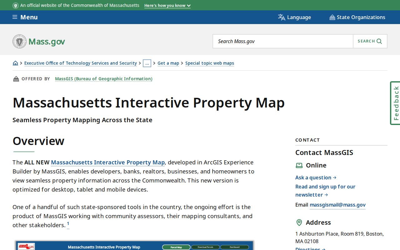
Use the parcel result to form a registry search, not to substitute for the deed. Bristol County municipal assessor submissions can be newer than the statewide layer, and MassGIS says its map lines and owner field are not authoritative title evidence.
| MassGIS field or control | How it works | Bristol County street-research use |
|---|---|---|
| Enter a location | Address, ZIP, street plus town, landmark, municipality, community, or coordinates | Find Bristol County map context while retaining the entered form. |
| Parcel click | Select a visible parcel | May expose a Bristol County owner field, land value, use description, and attributes. |
| Parcel table filters | Current extent or selected parcel | Narrows visible rows to the mapped area. |
| OWNER1 | Assessor-supplied attribute | A Bristol County first-owner value to verify in a Registry instrument. |
| SITE_ADDR and OWN_ADDR | Site and tax-mailing fields | Shows why a Bristol County parcel location and correspondence address may differ. |
| LS_BOOK, LS_PAGE, REG_ID | Reference fields when supplied | Useful paths into Bristol County deed, plan, or registered-land research. |
Note: Record the Bristol County map access date and the municipality’s fiscal-year context because parcel submissions do not all update on the same schedule.
Bristol County Street Address Labels
Bristol County address records can use several labels for the same place. The legal town in an assessor table, MassGIS Community, a postal city, a ZIP, and the Registry district are not interchangeable fields. A North Easton, South Dartmouth, Raynham Center, or Westport Point mailing label may need a legal-town check before a Registry search. For edge cases, compare the address in MassGIS with the USPS response, then preserve both the successful and failed town searches in the note.
- Parcel
- A mapped tax or land unit maintained for assessment. It may not match a legal title description exactly.
- Situs address
- The physical site address assigned to a parcel. It is distinct from a tax mailing address.
- Plat or plan
- A recorded or approved drawing that can show lots, roads, boundaries, or a subdivision context.
- Criss-cross directory
- An address-first directory that lists an occupant or subscriber associated with an address in a dated edition.
A reused number can signal demolition, subdivision, renumbering, or a renamed street. Compare nearby cross streets, lot or plan references, and the legal description before treating two Bristol County address records with identical numbers as the same place.
Bristol County Street Map Layers
MassMapper offers another Bristol County street directory orientation tool. Its location search accepts an address, ZIP, street plus town, landmark, municipality or village, neighborhood, coordinates, and typeahead terms. Parcel information is only one layer. Political and administrative, infrastructure, cultural-resource, conservation, coastal, imagery, and topographic layers can help explain the setting around a street.
Use those layers to test Bristol County street continuity, nearby roads, or historic landscape, but preserve the layer date and publisher. An aerial image cannot establish current occupancy, an informal neighborhood boundary, or legal title. For an address close to a municipal edge, the map is a useful reason to test both a postal label and the legal town in the Registry search.
Bristol County Street Directory Districts
Land records are divided among three Registry districts, so a Bristol County street directory cannot use one countywide deed form. Northern Bristol in Taunton serves Attleboro, Berkley, Dighton, Easton, Mansfield, North Attleborough, Norton, Raynham, Rehoboth, Seekonk, and Taunton. Bristol Fall River serves Fall River, Freetown, Somerset, and Swansea. Southern Bristol in New Bedford serves Acushnet, Dartmouth, Fairhaven, New Bedford, and Westport.
Northern’s recorded-land index states coverage from 1735 to the present, while its separate Land Court index starts in 1903. Fall River’s online grantor/grantee route emphasizes 1956 to the present, although older material remains with the Registry. Southern’s old-index books are arranged in listed ranges beginning in 1690. A Bristol County date outside a web span calls for the Registry counter, a direct request, historical books, or an archive, not a conclusion that no record exists.
| Address-keyed source | Bristol County keeper | What it contributes | Access route |
|---|---|---|---|
| Parcel record | Bristol County municipal assessor and MassGIS layer | Site, owner field, values, use, book/page, and registry ID when supplied | State map, municipal database, assessor office, or records request for existing files |
| Recorded-land index | Registry district selected by legal town | Grantor/grantee, type, recording date, and book/page or instrument reference | Online where covered, Registry terminal, mail, phone, fax, or direct request |
| Land Court or registered land | Registry district | Certificate, document number, and plan trail | Separate registered-land search and district copy route |
| Plan or permit file | Registry and municipal planning or building office | Lots, road context, construction, or alteration event | Plan search or municipality-specific request |
| Historic directory or map | Library, museum, archive, or Library of Congress | Dated address, building, business, or household context | Digital collection, local-history desk, or onsite holdings |
Northern Bristol Street Search Details
Northern Bristol’s Recorded Land Street form takes a start date, end date, document type, street number, street name, and town. The number is secondary or optional. Street name and town are the important location filters. Northern expressly warns that not every document has a street number or name, so follow every useful street hit with a grantor, grantee, or both-party search.
The Registry street-search source displays the location fields and the warning about incomplete street data.
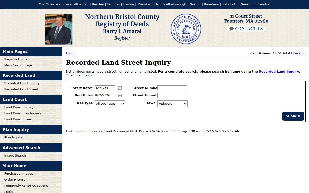
The form is strongest when the legal town and date window are already known. Use a broad window first, then narrow by document type and number. Northern also has separate Bristol County Recorded Land, Land Court, plan, and Advanced Image Search paths, which should not be merged into one result set.
| Northern Registry field | Format | Practical use |
|---|---|---|
| Start Date and End Date | Required dates | Bounds the street inquiry. |
| Doc Type | Required dropdown | Limits results to a recorded instrument category. |
| Street Number | Secondary text field | Try it, then repeat without it. |
| Street Name | Required text field | Test formal suffixes, abbreviations, and older forms. |
| Town | Required selection | Use the legal municipality served by Northern Bristol. |
Bristol County Street Directory Evidence
Each Registry uses a different interface and coverage note. Fall River offers a town selector, recorded-date range, party fields, and document type; its older books and staff routes matter before the web index span. Southern Bristol directs users through its newer image system and cautions that a web encumbrance list is not a title opinion. It also advises testing spaced and unspaced surname forms. The right response to a missing Bristol County street entry is a name search and a district-specific copy or counter route.
For a parcel that may be registered land, check the separate Land Court path. For a plan reference, use the plan search or book/page route. Certified copies, ordinary copies, online image access, and an index result are separate products. Save the source URL, search date, document type, party role, book/page or instrument number, and any visible redaction.
Note: A grantor transfers an interest and a grantee receives one, so the same name may appear on either side of different instruments.
Older Bristol County Street Clues
For an older address, use a dated map or directory before assuming a current street form will work. The State Library inventory identifies repeated Fall River directory editions from the nineteenth and twentieth centuries, and the Fall River Public Library keeps a local-history collection with selected directories, maps, and newspapers. Sanborn sheets add building footprint and street geometry at the edition date. They do not provide a current resident list.
Taunton’s local-history route includes the Old Colony History Museum, founded in 1853 and focused on Southeastern Massachusetts and pre-1850 research material. Its former Bristol Academy building and the county-seat setting make it a useful historical context source, not evidence about a particular household. A dated directory entry, Sanborn sheet, deed reference, and parcel note can test whether an old address line points to the same physical place.
Historical directory collections are described in more depth in the Bristol County city directory. Here, the useful task is to carry a dated address clue back into the map and deed trail.
Bristol County Street Checks for One Voter
The Massachusetts Voter Registration Search is an individual status form. It requires first name, last name, birth month, birth day, birth year, a five-digit ZIP, and an agreement checkbox. It can confirm a registration-status match and limited election information for the entered identity. It is not a public Bristol County street directory of names or addresses.
When someone has moved, the Secretary’s search tips say to try the former ZIP and allow two to three weeks for a new registration or update. Central voter-registry names and addresses are restricted by M.G.L. c.51, §47C. Historical voting lists and municipal election records are different collections and need their own repository and year check.
Limits of a Bristol County Street Directory
A Bristol County street directory can connect address-keyed public records, but it cannot establish every person at an address. Maps do not show complete households. A parcel owner may be a trustee, estate, organization, or off-site mailing recipient. A recorded instrument proves a recorded transaction or role, not continuous possession. A voter result checks one submitted identity and does not make an address list public. A missing search result means only that the entered spelling, town, date, and system coverage did not produce a match.
Massachusetts ACP participants may use a substitute address, and sealed, impounded, juvenile, vital, or confidential voter material has separate access limits. A narrow request under M.G.L. c.66 and 950 CMR 32.00 et seq. asks a custodian for existing non-exempt records; it cannot override a statutory restriction. If a public record appears wrong, keep the source details and contact the office that created it.