
Bristol County ZIP Codes and Places
Bristol County has a working list of 43 ZIP codes for routing research. That list includes standard delivery labels and postal-place labels, not a legal boundary map. A specific address should always be checked with USPS before a form is submitted. The practical value of the ZIP code directory is to keep the postal label alongside the legal municipality, MassGIS community, Registry district, and source date rather than quietly treating them as the same thing.
| ZIP | Areas covered in the working list | Post office label | Research note |
|---|---|---|---|
| 02048 | Mansfield | Verify with USPS by address | Postal result is not a Registry district. |
| 02334, 02356, 02357, 02375 | Easton, North Easton, South Easton | Verify by the exact delivery address | Postal-place detail can differ from town-field usage. |
| 02720-02724 | Fall River | Verify by the exact delivery address | Fall River Registry routing is separate from a ZIP label. |
| 02740-02746 | New Bedford and nearby postal places | Verify by the exact delivery address | Check the legal town before Southern Registry work. |
| 02747, 02748, 02790, 02791 | North Dartmouth, South Dartmouth, Westport, Westport Point | Verify by the exact delivery address | Postal place and municipality can differ. |
| 02760, 02761, 02763, 02764, 02766-02780 | North Attleboro, Attleboro Falls, North Dighton, Norton, Raynham, Rehoboth, Seekonk, Swansea, Berkley, Taunton | Verify by the exact delivery address | Use the correct town in Registry and court forms. |
The working list also includes Assonet, Dartmouth, Dighton, East Freetown, East Taunton, Fairhaven, Acushnet, Somerset, and other local labels. It is intentionally not a substitute for USPS or a complete municipal-overlap table, because the research did not locate one official countywide ZIP boundary inventory.
Bristol County ZIP Code Verification
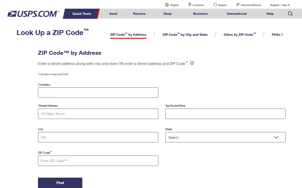
USPS ZIP Code Lookup is the authority for the postal code and mailing format of a particular address. Enter the address, retain the returned postal city and ZIP, and save the result date. Then use the road, number, and legal municipality where a court, Registry, assessor, or municipal clerk asks for them. A postal-place result can be useful for mail but still be the wrong value for a deed search town selector.
The official USPS address form is shown in this source image.
The result is a postal verification step, not evidence of a parcel owner, current household, or legal boundary.
Note: Keep an address’s postal city and its legal municipality as separate fields when they differ across Bristol County systems.
Searching Bristol County by ZIP Code
A ZIP narrows a starting area; it does not turn the state’s individual lookup forms into ZIP-wide directories. MassMapper accepts an address, ZIP, street plus town, landmark, municipality, community, or coordinates to open map context. The Massachusetts voter tool requires one person’s name, birth date components, and ZIP. Its terms and the state’s central-registry confidentiality rule mean it should not be used to make a list of people in a ZIP.
- Verify the full address and ZIP with USPS, including the returned postal city.
- Enter the address or ZIP in MassMapper and inspect the parcel or map context, preserving the layer date.
- Record the legal town shown by the relevant government source before choosing a Bristol Registry district.
- Search that Registry by the party and town, then use street terms only as a second route where the portal offers them.
- When the area narrows to a road and house number, continue with the Bristol County street directory workflow.
Municipal assessors can have newer local data than a statewide layer. For a city or town property card, call or write the assessor office and give the complete address, municipal name, and date needed. For an older historical snapshot, the local library, museum, or archive may be the better fallback.
Bristol County ZIP Map Search Fields
MassMapper is a map interface rather than a fixed ZIP-search form. Its location box accepts a ZIP as one way to orient the map, then a parcel click can reveal available attributes. The state’s parcel material explains that the map is assessor-derived and that municipal updates vary. Use the interface to find a place and nearby record clues, not to infer a complete set of residents for a postal area.
| Control | Accepted input or action | Useful ZIP code directory role |
|---|---|---|
| Enter a location | Address, ZIP, street plus town, landmark, municipality, community, or coordinates | Places the search in the right map area. |
| Layer selection | Parcel, imagery, political/admin, infrastructure, cultural, coastal, and other layers | Shows context while preserving layer source and date. |
| Parcel click | Select a visible parcel | Opens available owner, valuation, and use attributes. |
| Find Abutters | Parcel plus optional distance in Municipal Mappers | Identifies adjacent parcels, not a resident list. |
The `Town` field and the MassGIS `Community` field can describe the same area differently. That Bristol County quirk is most likely to matter near municipal edges or when a postal place is used as a search town.
Bristol County ZIP Address Matrix
A Bristol County ZIP note is strongest when it records the exact identity field from each Bristol County source. Bristol County postal routing, Bristol County map context, and Bristol County Registry routing are all valid, but they answer different questions. A Bristol County address may require a Bristol County legal-town check even after a Bristol County USPS response looks clear.
| Bristol County system | Bristol County field to save | Bristol County use |
|---|---|---|
| Bristol County USPS result | Postal city and ZIP | Bristol County delivery formatting |
| Bristol County MassGIS result | Town, Community, and map date | Bristol County map orientation |
| Bristol County parcel result | Site address and parcel clues | Bristol County assessor cross-reference |
| Bristol County Registry form | Legal municipality and district | Bristol County deed routing |
Bristol County ZIP and ZCTA Boundaries
A Census ZIP Code Tabulation Area, or ZCTA, is a statistical approximation of ZIP geography. It should not replace the Census guidance or a USPS address check for mail delivery. Neither a ZCTA line nor a map label decides an official city, town, county, or Registry boundary. A Bristol County record search should preserve which geography a source actually uses.
For a boundary address, run the location through both USPS and MassGIS, test the legal town in the Registry or court form, and retain any failed-town attempt in the search notes. This is a records-routing problem, not evidence that the address is absent.
Bristol County ZIP Code Terms
The language around a ZIP code matters because it tells the reader what kind of geographic claim a result supports. The following terms keep a postal lookup from being presented as a municipal or personal record.
- ZIP code
- A postal routing code used by USPS, not a legal municipal boundary.
- ZIP+4
- An added delivery-segment code that refines routing for a particular address or range.
- PO Box ZIP
- A ZIP used for post-office box delivery; it does not locate a physical parcel.
- Unique ZIP
- A specialized postal designation that must be confirmed for the exact address or organization.
- Carrier route
- A postal delivery grouping, not a list of all people who live in an area.
A record may also hold a site address, mailing address, registry town, and MassGIS community. Those values should remain distinct in a Bristol County ZIP code directory note.
Bristol County ZIP Code District Routing
ZIP geography must give way to the Registry district’s municipality list. Northern Bristol is the route for Attleboro, Berkley, Dighton, Easton, Mansfield, North Attleborough, Norton, Raynham, Rehoboth, Seekonk, and Taunton. Fall River serves Fall River, Freetown, Somerset, and Swansea. Southern Bristol serves Acushnet, Dartmouth, Fairhaven, New Bedford, and Westport. Once the municipality is known, search the correct district’s name index and compare the recorded instrument with the parcel reference.
The time period matters as much as the location. Northern notes a recorded-land index beginning in 1735; Southern’s digitized old indexes begin with a 1690 range; Fall River’s online index emphasizes 1956 forward. Older results may require a counter, mail, phone, fax, or direct Registry route rather than a broad web search.
Bristol County Postal History Checks
Older address research needs another layer of care. A historical directory can carry an older house number, street spelling, ward, or postal form. Compare it with the directory edition year, a Sanborn map index, assessor information, and a Registry plan or legal description before assuming it is the same modern address. Addresses can be changed by renumbering, subdivision, demolition, or a street-name change. The mismatch is a research question, not a reason to force a current ZIP code onto an older record.
The Library of Congress Sanborn research route supports city, county, edition, and sheet searching. Fall River, New Bedford, Attleboro, Fairhaven, Somerset, Swansea, and Westport have identified Bristol-area examples. A sheet shows the built setting at its date, not a current postal or household record.
Bristol County ZIP Code Directory Limits
A ZIP code directory can support careful address routing, not a claim about everyone in a postal area. It cannot establish a complete household, a current occupant, a voter list, title, a neighborhood border, or a historical move. The assessor map identifies parcels and administrative fields. The Registry identifies recorded instruments. A historical directory identifies a dated edition. Each source answers a smaller question.
Protected addresses and agency redactions also matter. Massachusetts Address Confidentiality Program participants use substitute mailing addresses, and a missing public result must not be triangulated into a substitute location. Use postal and government systems for lawful personal research, local history, estate matters, or a source check, and stop where the custodian’s access rule stops.